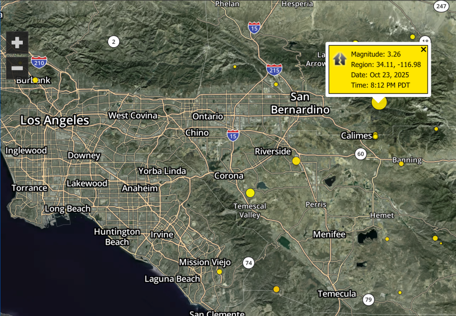
Did you feel it? A 3.3 magnitude earthquake struck in San Bernardino County Thursday evening.
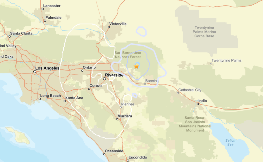
The temblor, according to the United States Geological Survey, struck in the San Bernardino National Forest at around 8:12 p.m. at a depth of nearly 7.5 miles, almost 5 miles north northwest of Oak Glen and an estimated 6.5 miles north northeast of Yucaipa.
USGS’s ShakeMap showed the quake may have been felt as far away as Los Angeles County.
No injuries or structural damage were immediately reported.
Hundreds of earthquakes are recorded in California each year. Most are extremely minor, however, dozens measure over 3.0 magnitude. According to the California Department of Conservation, the strongest quake ever recorded in the Golden State measured 7.9 magnitude and struck Fort Tejon on Jan. 9, 1857.
KTLA’s interactive map to track the latest earthquakes in Southern California can be found here.
Anyone who may have experienced shaking in their area can fill out the USGS Felt Report online.