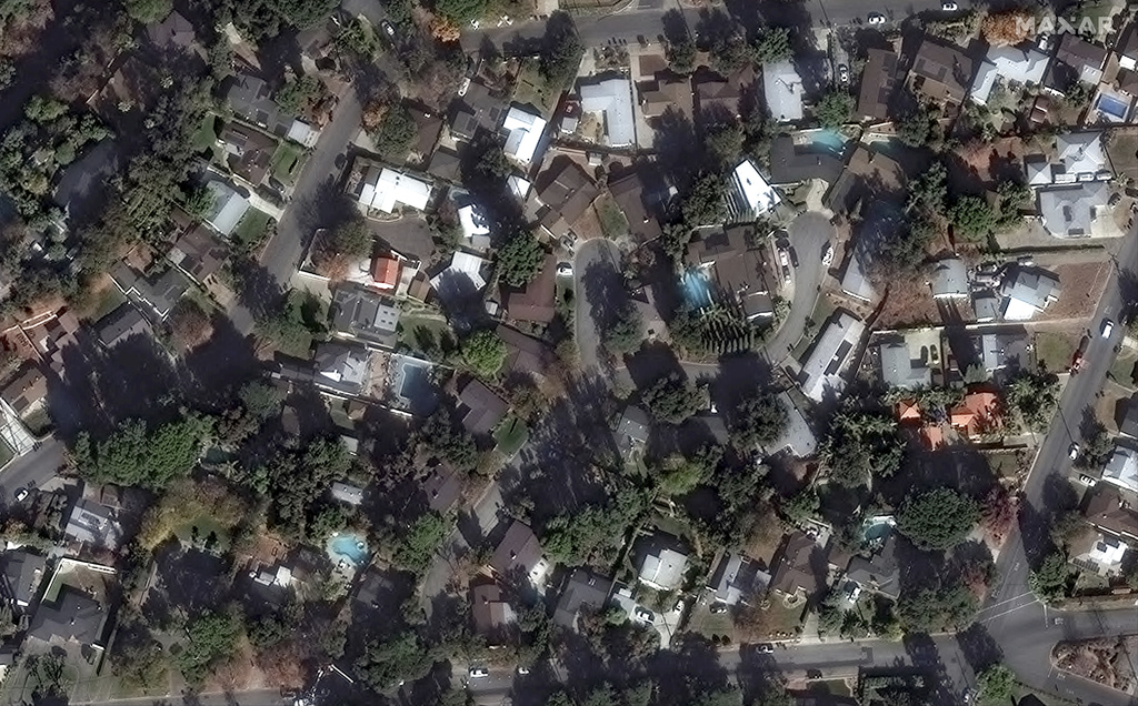
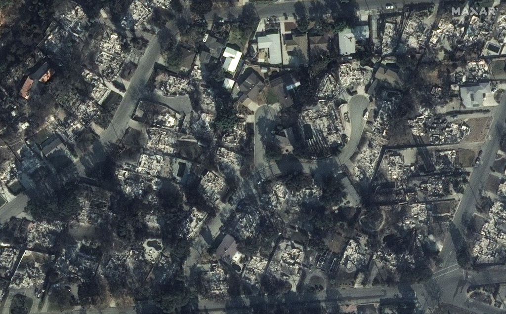
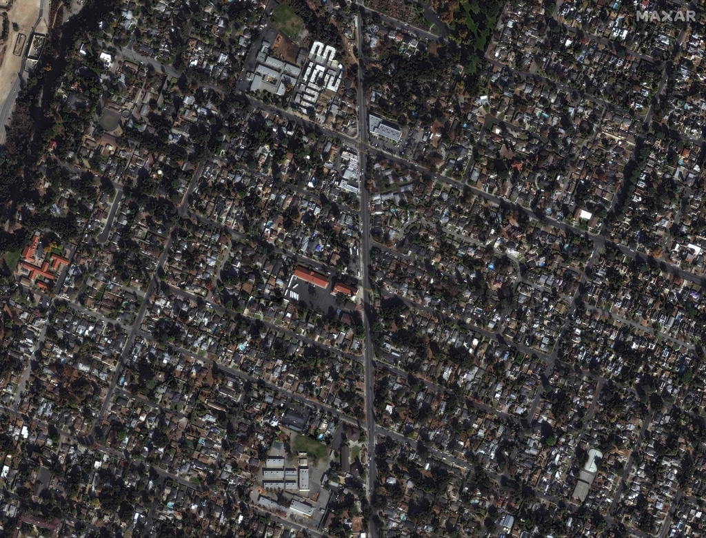
LOS ANGELES (KTLA) – Satellite images are providing a unique and heartbreaking view of the devastation in the Pacific Palisades, Malibu, Altadena and Pasadena from two wildfires that have scorched more than 34,000 acres, destroyed at least 10,000 structures and claimed 10 lives.
Maxar Technologies has shared before-and-after images of several neighborhoods ravaged by the Palisades and Eaton wildfires. Use the slider below to compare the photographs.


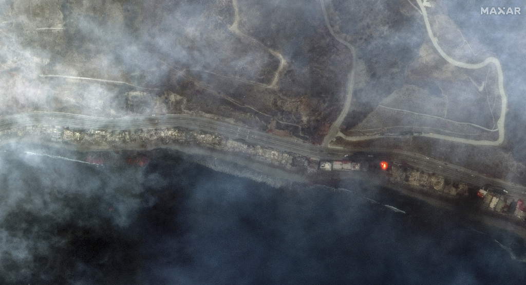


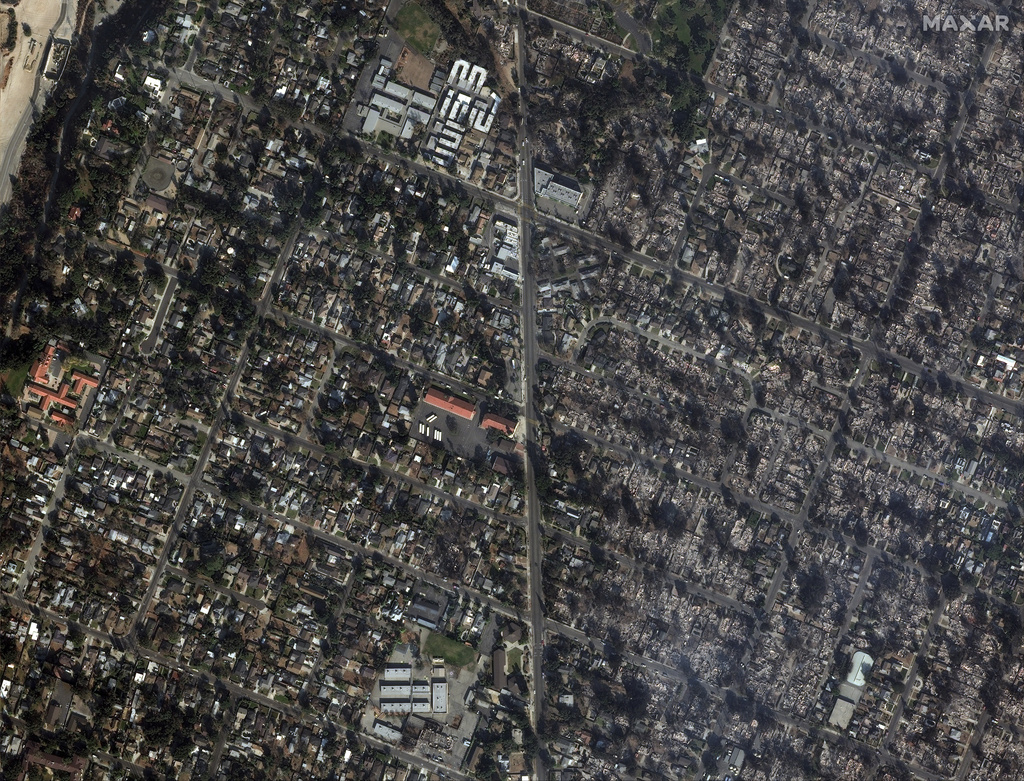
The fires erupted on Tuesday as dry, hurricane-force winds swept through Southern California, which hasn’t seen significant rainfall since early 2024. Experts believe the damage will far exceed $100 billion.
President Joe Biden has declared a federal emergency, clearing the way for federal funds to help cover the firefighting efforts and assist in the recovery.